Usluge
- Promenada 13, 22000 Sremska Mitrovica, Srbija
- [email protected]
- +381 22 62 45 83
- +381 22 21 50 240


Imamo višegodišnje iskustvo u oblasti geodezije, geoinformacionih sistema, kao i svih vrsta obrada prostornih podataka. Znanje u upravljanju projektima je razvijano na lokalnom i internacionalnom tržištu. Naši stručnjaci će vam pomoći da vaš projekat sistemski i tehnički postane izvodljiv i održiv, a naša operativa će dovesti vaš projekat do realizacije.
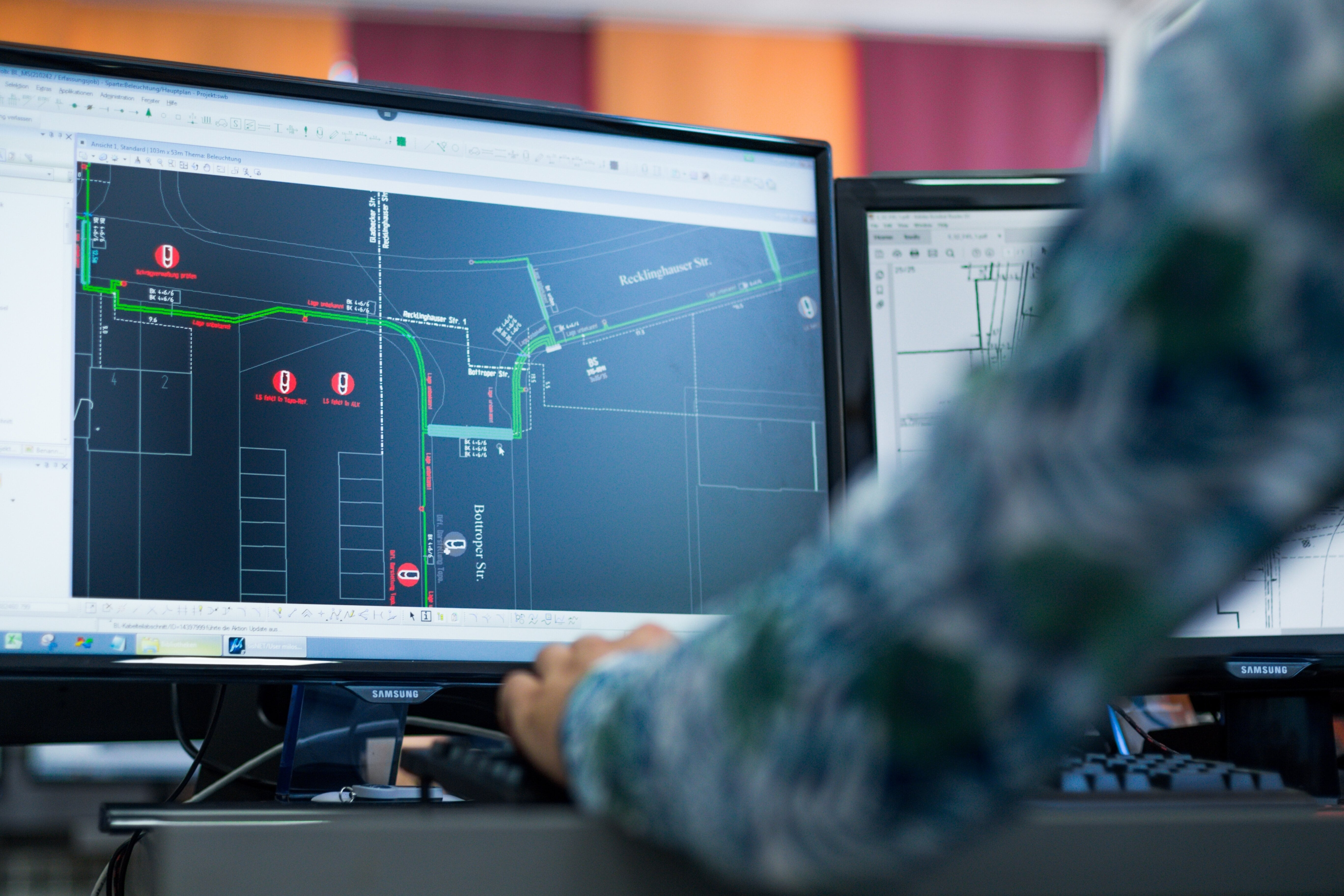
Usluge GIS-a obuhvataju upotrebu prostornih podataka za mapiranje, analizu i podršku u različitim oblastima, od infrastrukture komunalnih vodova i urbanog planiranja do zaštite životne sredine.
DETALJNIJERazvoj GIS-a je stvaranje i unapređenje sistema za efikasno upravljanje, analizu i vizualizaciju prostornih podataka.
DETALJNIJEMapiranje u 3D formatu je predstavljanje stvarnih objekata u trodimenzionalnom prostoru, omogućavajući detaljniji prikaz i bolje razumevanje prostora.
DETALJNIJEGeodetsko snimanje je proces merenja i mapiranja zemljišta, pružajući osnovne podatke za građevinske projekte, upravljanje zemljištem i razvoj infrastrukture.
DETALJNIJEPlaniranje optičkih pasivnih mreža za stambene i poslovne korisnike. Pružamo usluge razvoja idejnog, glavnog i izvedenog dizajna. Projektujemo optičke pristupe i mreže dugih razdaljina.
DETALJNIJEKonsalting uključuje profesionalnu, tehničku, pravnu i organizacionu podršku klijentima tokom planiranja i realizacije njihovih projekata.
DETALJNIJENaši dugogodišnji zadovoljni klijenti dokaz su našeg kvaliteta i stručnosti.