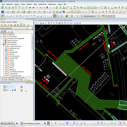
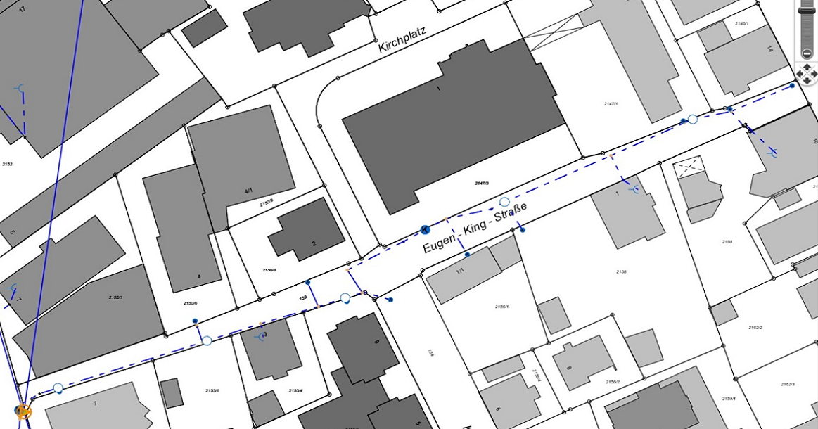
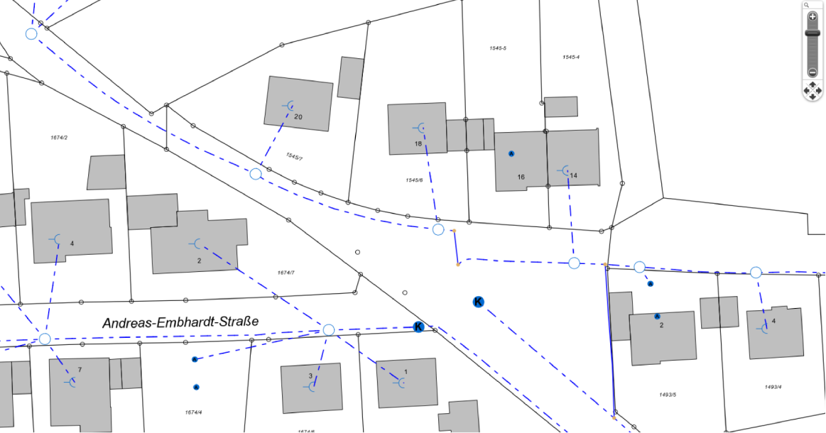
Digitization involves the process of converting physical maps, drawings, or other analog data into digital formats. This is done to create digital representations of geographic features and information. There are various methods for digitizing geodata, including manual digitization using digitizing tablets, heads-up digitization in GIS software, and automated methods like satellite and aerial imagery analysis. Digitized geodata can be used for mapping, analysis, and visualization in GIS applications, urban planning, environmental monitoring, and more.
Geospatial datasets need to be regularly maintained and updated to ensure their accuracy and relevance. This involves correcting errors, adding new data, and revising existing information. Updates can be based on field surveys, remote sensing data, user-contributed data, or data from authoritative sources. Updated datasets are crucial for decision-making, disaster response, infrastructure planning, and other applications that rely on accurate geographic information.
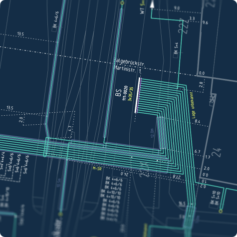
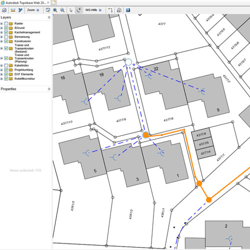
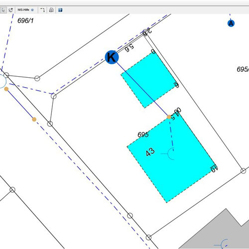
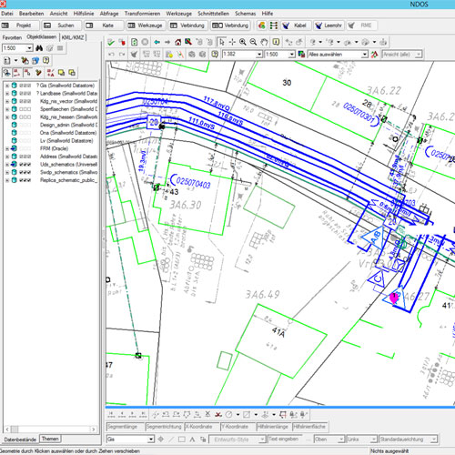
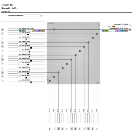
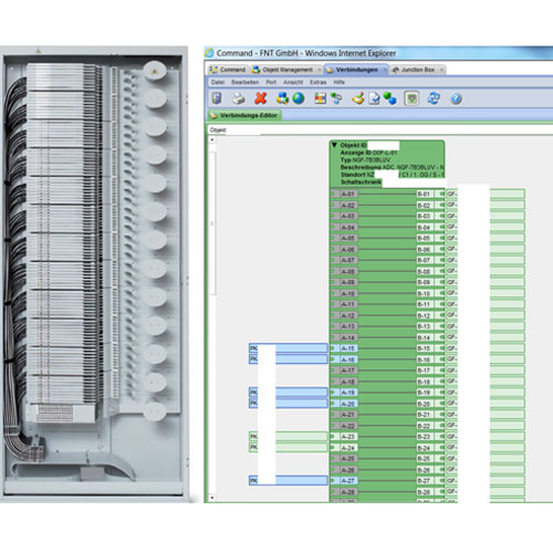
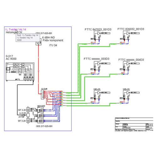
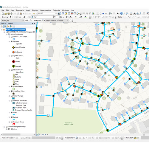
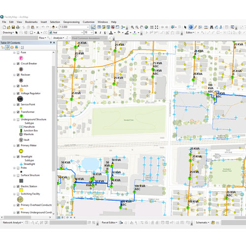
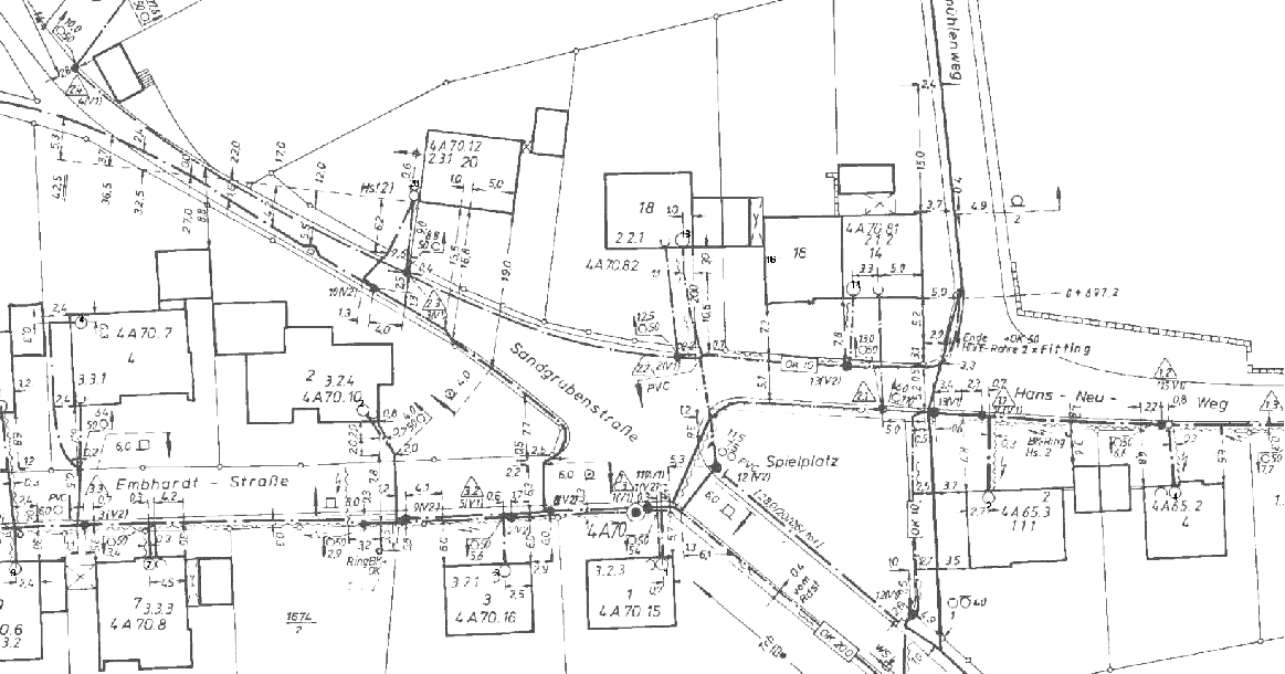
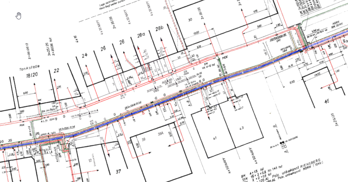
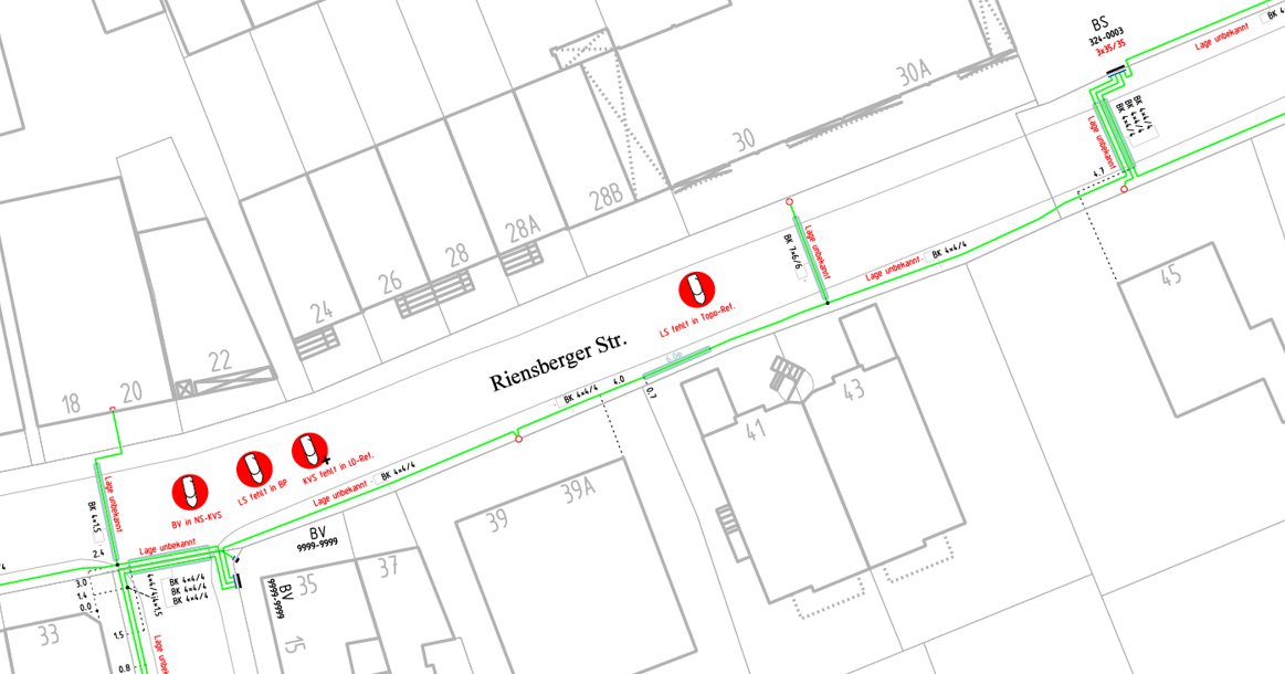
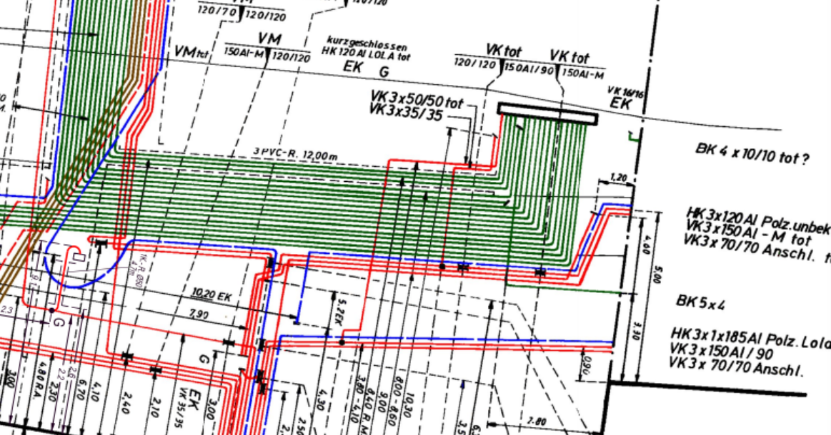
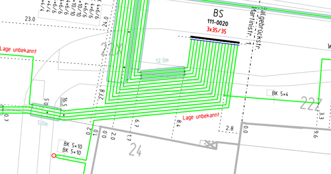
Documentation of linear infrastructure networks involves creating detailed records of linear features like roads, railways, pipelines, and utility networks. This documentation can include attribute information such as location, type, condition, maintenance history, and more. Accurate documentation of linear infrastructure is essential for infrastructure management, asset tracking, and maintenance planning.
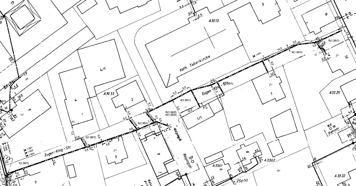
Converting analog data to digital formats involves transforming physical data sources, such as paper maps or photographs, into digital files that can be stored and analyzed in GIS software or databases. This process can include scanning, georeferencing, and manual or automated digitization. Digital formats allow for easier data storage, analysis, and integration into GIS systems, enabling better decision-making and information sharing.
Network inventory documentation is a comprehensive record of an organizations network infrastructure, including hardware, software, and configurations. It serves as a crucial reference for IT professionals, aiding in troubleshooting, upgrades, and maintenance. Accurate and up-to-date documentation enhances efficiency, security, and overall network management.
Digitization of cadaster analog datasets involves converting paper-based land records into digital formats. This process enhances accessibility, efficiency, and data management in land administration. By utilizing advanced technologies, such as GIS, it facilitates faster updates, improves accuracy, and supports effective decision-making in the management of cadastral information.